Google Maps upset Ukrainians' positions photos: Russians actively using snapshots.


Updated Google Maps photos 'revealed' the locations of Ukrainian military positions.
Head of the Center for Countering Disinformation (CPD) Andriy Kovalenko reported that updated Google Maps photos revealed the locations of Ukrainian military positions. He appealed to Google Maps to correct this situation, but received a response that it was impossible due to the weekend. Russians, in turn, are actively using these snapshots.
"Imagine the situation. Google posts updated images on maps showing the locations of our military systems. We asked them to quickly correct this, but they said they are off on weekends. Russians are already actively using these snapshots. What is wrong with this world?" - Kovalenko wrote.
After the public reaction, the head of CPD reported that he contacted Google representatives. They are already working on correcting the situation with snapshots of the locations of Ukrainian military systems.
"We will also discuss how to promptly resolve similar issues in the future," - Kovalenko added.
Reminder, Russia attacked Kyiv and the region with drones overnight.
Read also
- Trump ready to ramp up sanctions against Russia amid ultimatum from the West – Bloomberg
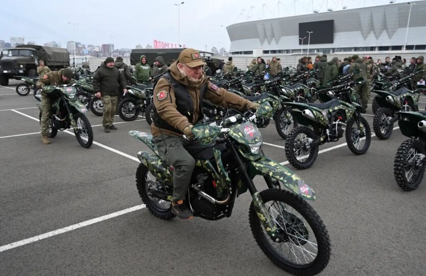
- Russian Army Transitions to Motorcycles for Assault Operations - Media
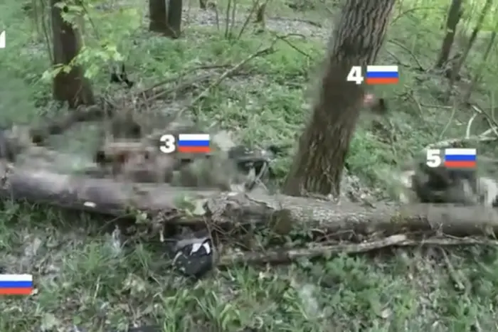
- Special Forces entered the enemy's rear and eliminated an assault group of eight Russians
- The Kremlin Uses the Ceasefire Theme for Manipulation - ISW
- On the Siverskyi direction, the Russians have accumulated motorcycles for storming the positions of the Armed Forces of Ukraine
- Support for Ukraine: Britain to Hold Meeting of EU Foreign Ministers